Map What’s Beneath
the Surface
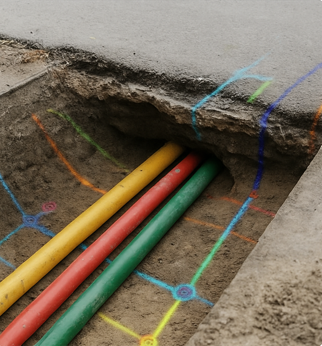
Our utility mapping services provide accurate data on underground infrastructure — helping engineers, contractors, and municipalities avoid costly surprises and plan with confidence.
- ✔ Ground Penetrating Radar (GPR)
- ✔ Electromagnetic Locators
- ✔ GIS-based Utility Documentation
Why Accurate Utility Mapping Matters
Avoid unnecessary digging, protect buried infrastructure, and improve planning efficiency — Plumb Surveying helps ensure your projects stay safe and cost-effective.
Minimize Risk
Prevent utility strikes and site shutdowns with high-resolution subsurface scans.
Improve Accuracy
Overlay verified utility locations directly onto GIS, CAD, and site plans.
Ensure Compliance
Meet regulatory requirements with verified and documented underground data.
Utilities Mapping with Precision
We use advanced geophysical tools and underground detection systems to accurately map subsurface infrastructure — ensuring safe, compliant, and efficient project planning.
- ✔ Underground utility detection (GPR, EM locators)
- ✔ Utility mapping in CAD/GIS formats
- ✔ Safe excavation and construction planning
- ✔ Integrated 3D visualizations and reporting
Subsurface Detection

CAD & GIS Formats

Safety-Compliant Planning

3D Visualization & Reports