What We Offer

Bathymetric Surveying
Multibeam and singlebeam sonar for seabed topography.

Tidal Observation
Accurate water level and tide measurements.

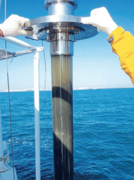
Seabed Sampling
Grab/core sediment sampling for analysis.

Nautical Charting
Survey outputs formatted for ports and marine navigation.
What Sets Plumb Surveying Apart
More than just measurements — we offer insight, precision, and peace of mind. Our hydrographic surveys are designed to deliver actionable data for safer, smarter marine decisions.

Precision-Driven
RTK GNSS, multibeam sonar, and QA protocols ensure accuracy at every depth.

Specialist Team
Certified hydrographers, GIS experts, and maritime engineers on every project.

Clear Reporting
You get visual maps, CAD-ready files, and GIS formats for seamless planning.

Responsive Support
We’re flexible, fast, and easy to work with — from quote to delivery.
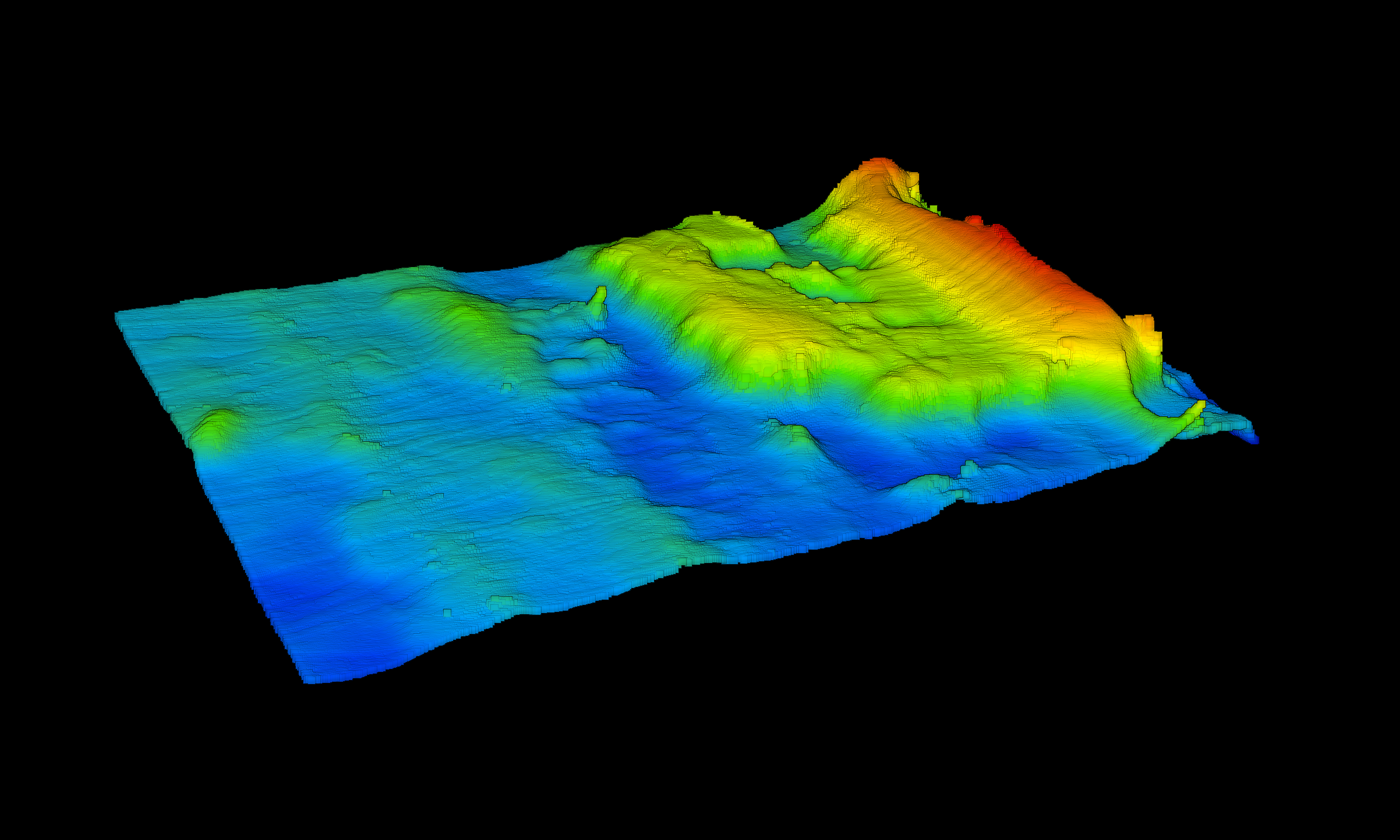
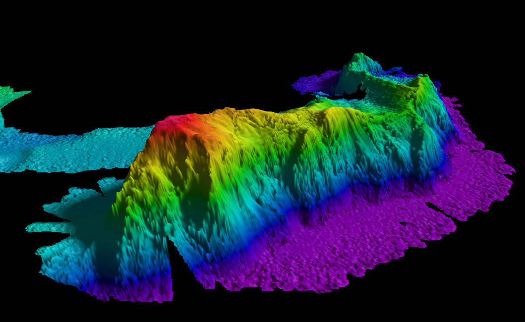
Explore the Seabed in 3D
At Plumb Surveying, we bring the underwater world to life using multibeam sonar, 3D bathymetric models, and advanced visualization tools. See depths, sediments, and structures like never before — with accuracy you can rely on.
Featured Hydrographic Projects
Harbor Bathymetric Survey
Multibeam mapping for port expansion using IHO-compliant methods.
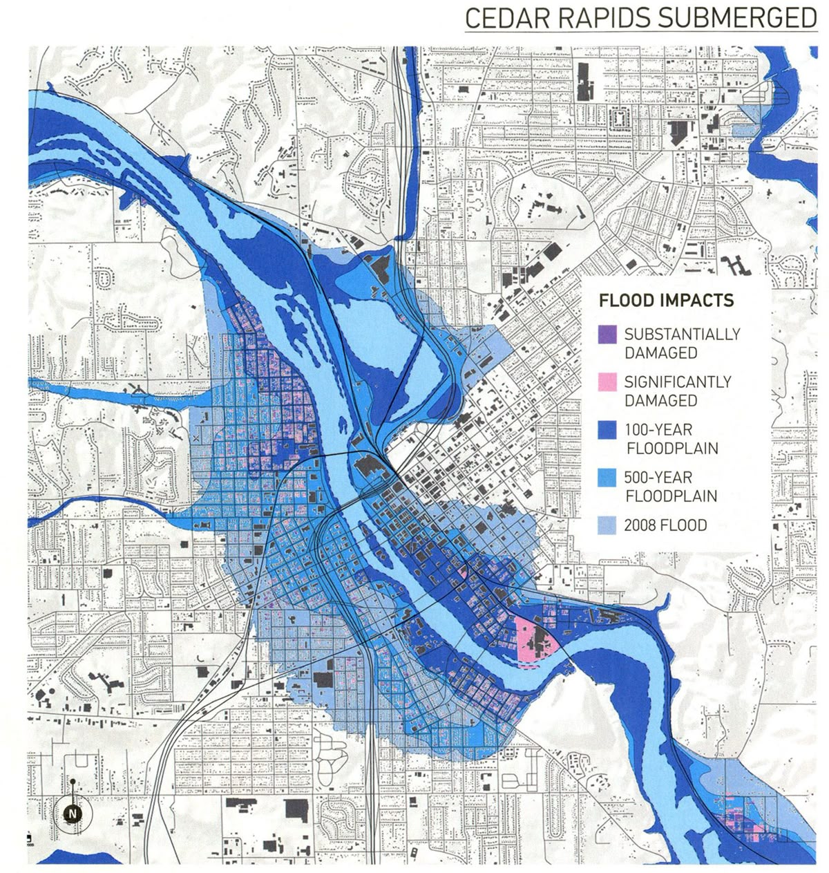
River Depth Monitoring
Seasonal riverbed scans for flood modeling and safe navigation.
Seabed Sampling & Sediment Study
Core and grab sample data for construction feasibility reports.